- Applications
- رفت و آمد
GPS Earth Live Satellite Maps
Images


Introduction
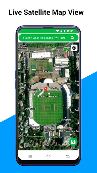
Move on maps and travel easily. Traveling on roads towards any location with voice instructions and real time satellite views is very easy now with GPS Live Earth Maps: Satellite View & Navigation. Just get this live satellite earth view location maps and navigate anywhere with voice instructions and have ultimate driving experience. Move on live earth satellite view & location finder maps and explore the world on global maps. See latest earth maps views through updated satellite map data and find your location on real time satellite live map. GPS Live Earth Maps: Satellite View & Navigation mapping will let you move on map. Get easy driving directions on live driving maps and follow route for destination location.
In GPS Live Earth Maps: Satellite View & Navigation voice maps give voice instructions on road. Search target destination location on map and draw route for easy & smooth journey. Follow route, move on the road and reach at destination location. This GPS driving directions & fast route finder application will draw best possible, easy and smooth route for easy traveling. This easy travel assistant & real time navigation map app is a powerful tool to get easy directions on road. Voice GPS navigation maps & directions app will let you have ultimate navigation & driving experience.
Real time traffic alerts with live transit map will show live traffic data on maps. Real time traffic information on roads can be seen through traffic map. Live traffic data help to escape from traffic. GPS Live Earth Maps: Satellite View & Navigation has speedometer that shows real time moving speed. Live moving speed can be seen through this GPS speedometer for android application. Set speed limit through speed limiter and get alerts when you cross your maximum speed limit.
Live 3D maps show real time 3D buildings on roads. GPS Live Earth Maps: Satellite View & Navigation will show 3D view of map. Live 3D satellite earth location & global maps will let you see 3D view of any location. Global earth 3D maps will update real time location on live satellite maps. Earth location maps also helpful for finding any location on map.
See live location on real time location map. Move on map and see updated location. Latitude & longitude updates in real time. Live GPS location help to find current location on map. See updated location on map.
Famous places are helpful for travelers to find target destination location. See famous places on map in 3D view and decide where to travel. STD codes of some countries are also available. Just select your desired country and see STD code of cities.
Address finder in GPS Live Earth Maps: Satellite View & Navigation is a powerful feature to find address on map. Find any address on map with address finder. Just tap on map and get address. Copy and share address with whoever you want.
Compass will let you see your directions. There are saved addresses, saved route, distance measurement and much more powerful features in this travel tool kit app.
Here are some key features of GPS Live Earth Maps: Satellite View & Navigation are:
• Live Earth Map View
• Live Navigation with Voice Instructions
• Real Time Traffic Map Shows Live Traffic Data & Updates
• Voice Map With Voice Directions
• Address Finder Help to Find any Address
• GPS Speedometer for Android Shows Live Moving Speed
• Speed Alerts Will Let You Set Maximum Speed Limit & Alert When You Cross Speed Limit
• Distance Measurement is Powerful Tool to Measure Distance Just by Tapping on Map
• Compass Shows Directions
• 3D Map for Satellite 3D View of Buildings on map

برنامههای مرتبط


دیگران نصب کردهاند


برنامههای مشابه


